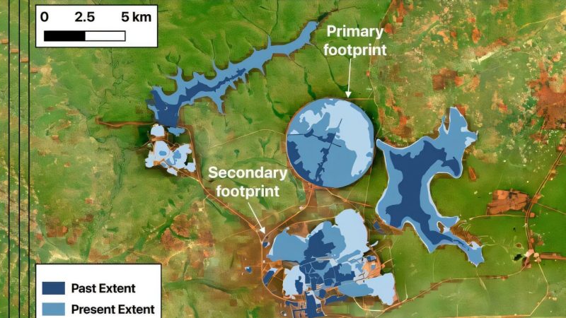
HZDR researchers create automated satellite tool to track mining site vegetation
A team at the Helmholtz-Zentrum Dresden-Rossendorf has developed a new automated satellite-based remote sensing tool to assess vegetation changes around mining facilities.