NASA satellites track historic El Niño unfolding in fall 2026
NASA scientists are monitoring a powerful El Niño event currently developing across the equatorial Pacific Ocean this fall of 2026.
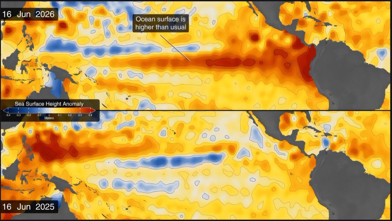
Satellite imagery reveals warm water swell
One of the first signs appeared in January 2026 when satellite data showed a Kelvin wave near Micronesia. This slow-moving pulse of water transfers heat from the western Pacific toward the east. The resulting air pressure changes weaken or reverse the trade winds that typically blow across the region.
NOAA predicts strongest event since 1950
As of October, the National Oceanic and Atmospheric Administration stated there is an 83 percent chance this is the strongest El Niño since 1950. The pattern involves warmer-than-normal water temperatures in parts of the equatorial Pacific. People around the world including farmers and coastal communities are already experiencing effects from these shifting conditions.
NASA tracks ocean heat redistribution
The phenomenon redistributes ocean heat and scrambles rain patterns across parts of the Pacific Ocean. Sea surface height is also changing as the system evolves. NASA continues to follow the development closely with its fleet of satellites.
Reported by one outlet
Only one outlet has published this. Nothing here has been checked against a second report, so read it as that outlet's account and follow the link below for the original.
Reported by
1 independent outlet. Headline as published. Links open the original report.