HZDR researchers create automated satellite tool to track mining site vegetation
A team at the Helmholtz-Zentrum Dresden-Rossendorf has developed a new automated satellite-based remote sensing tool to assess vegetation changes around mining facilities.
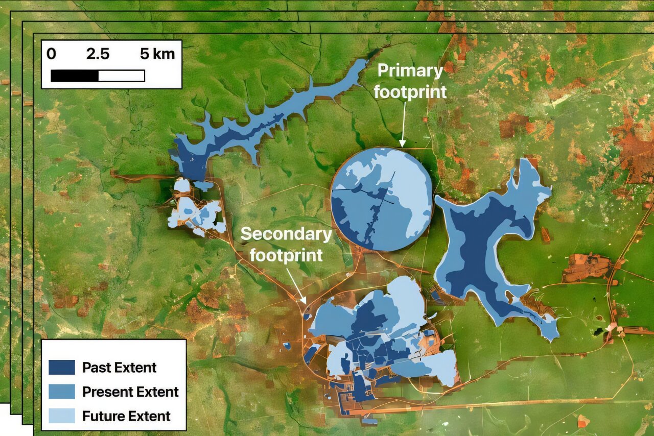
New Tool Monitors Environmental Impact
The research group built this system specifically to measure the spatial extent of mining operations. It allows for better assessment of how these facilities affect surrounding plant life. The technology tracks shifts in vegetation from deforestation to reclamation phases.
Automated System Tracks Changes
This automated tool processes data from satellites to identify environmental shifts automatically. Researchers can now monitor large areas without needing constant manual inspection of every site. The method helps quantify the total area affected by mining activities over time.
Reported by one outlet
Only one outlet has published this. Nothing here has been checked against a second report, so read it as that outlet's account and follow the link below for the original.
Reported by
1 independent outlet. Headline as published. Links open the original report.